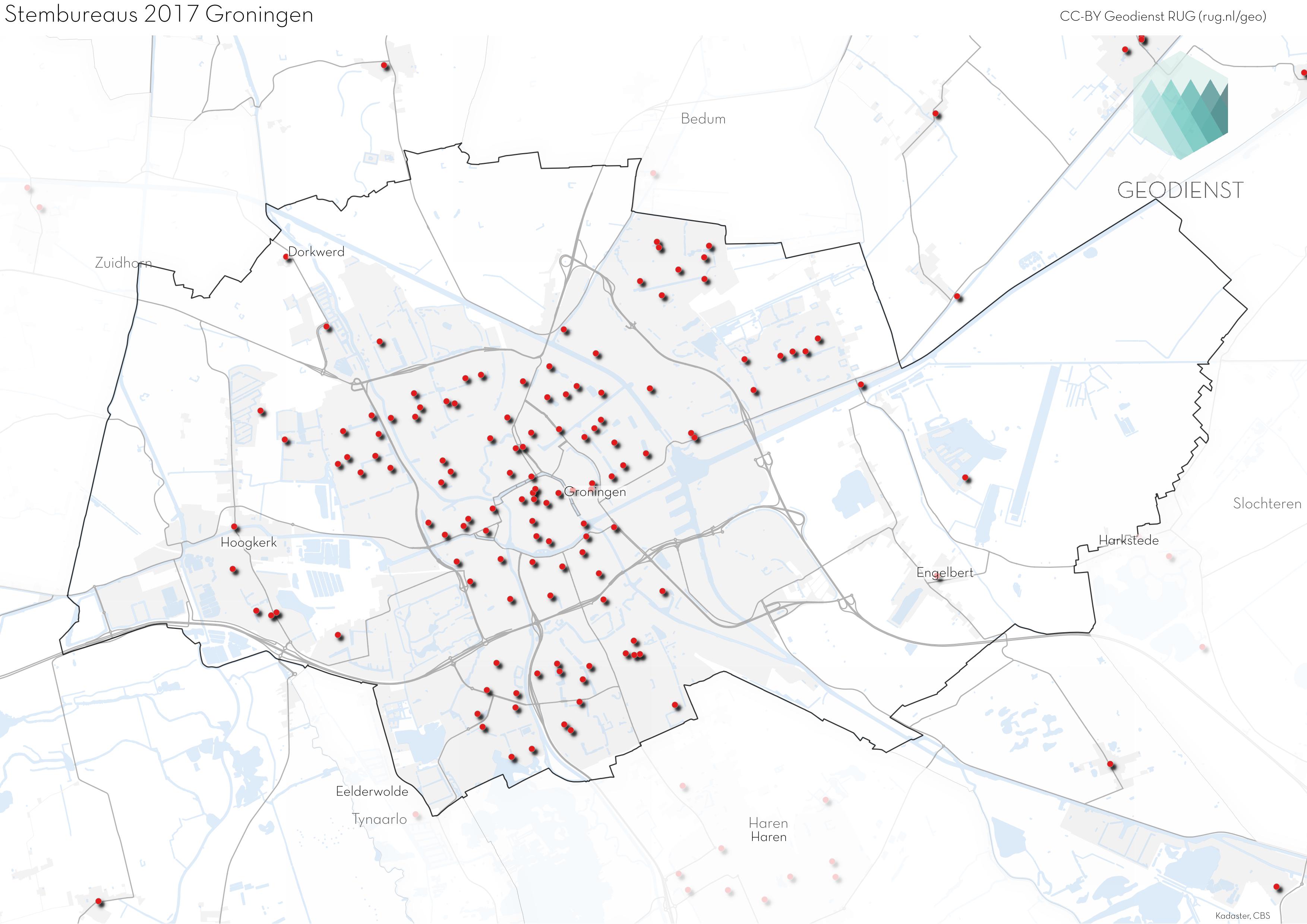
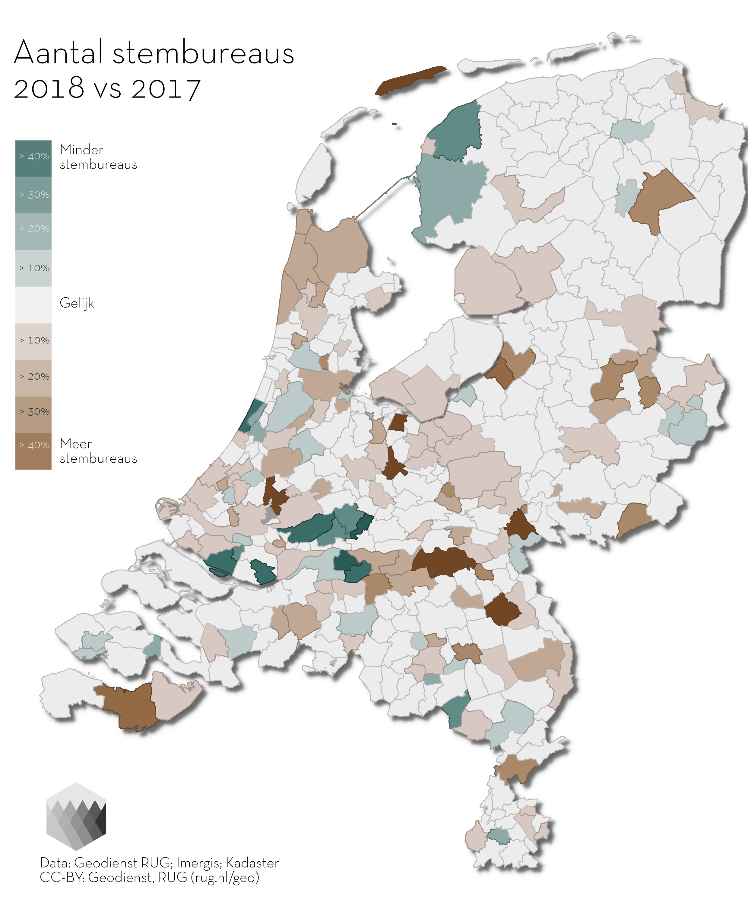
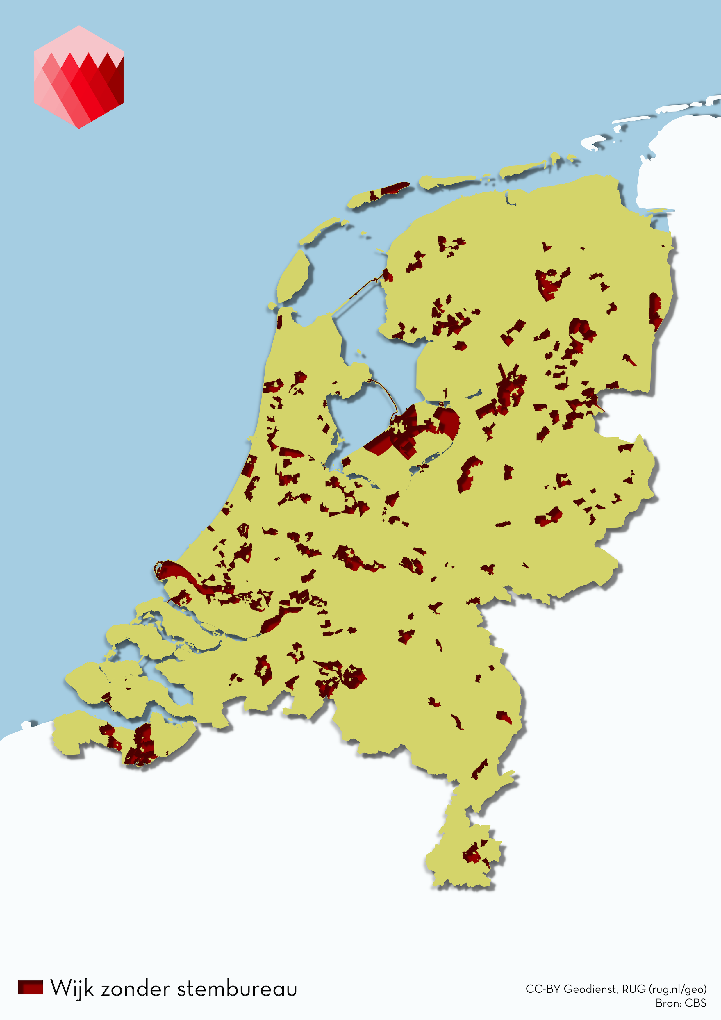
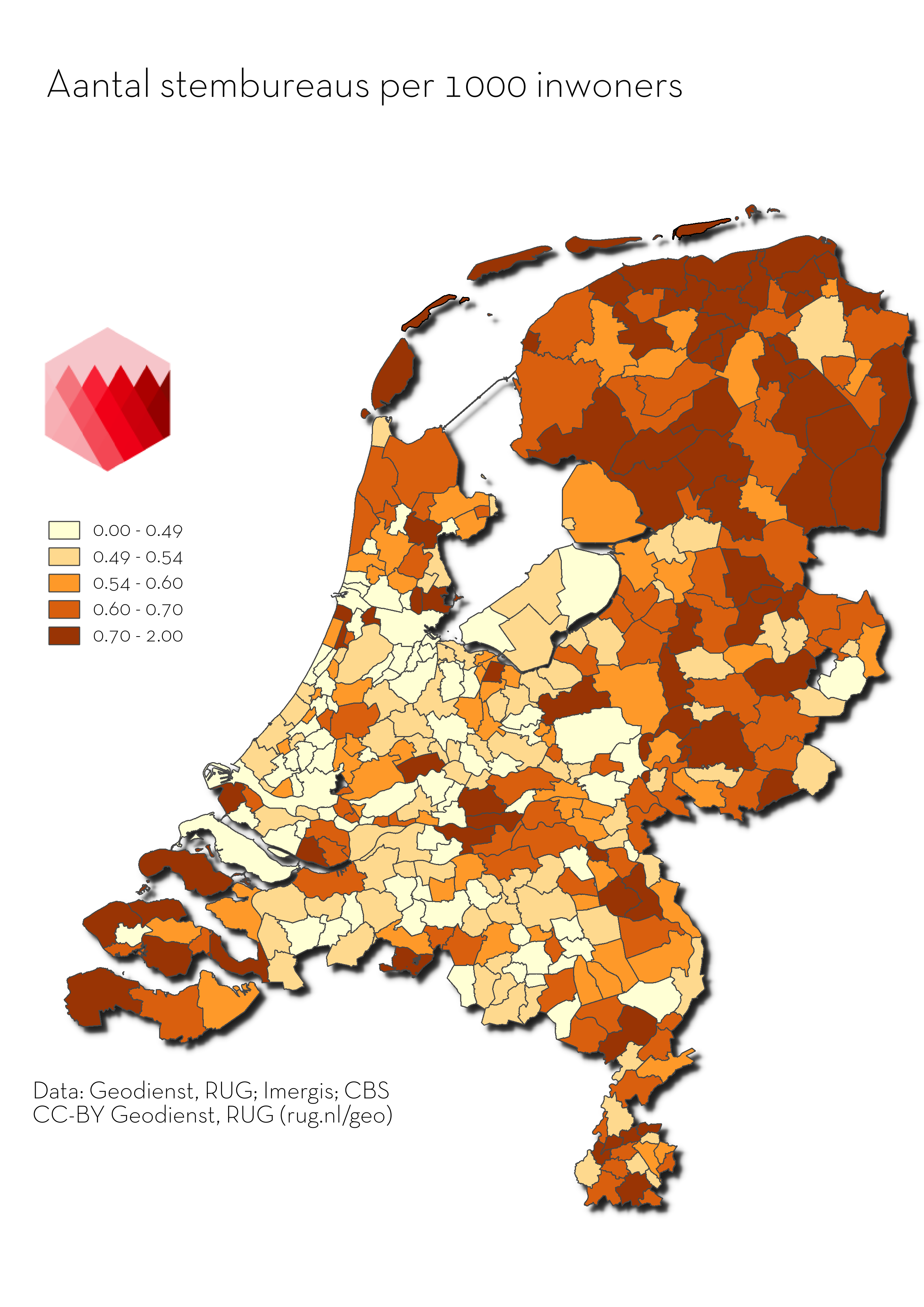
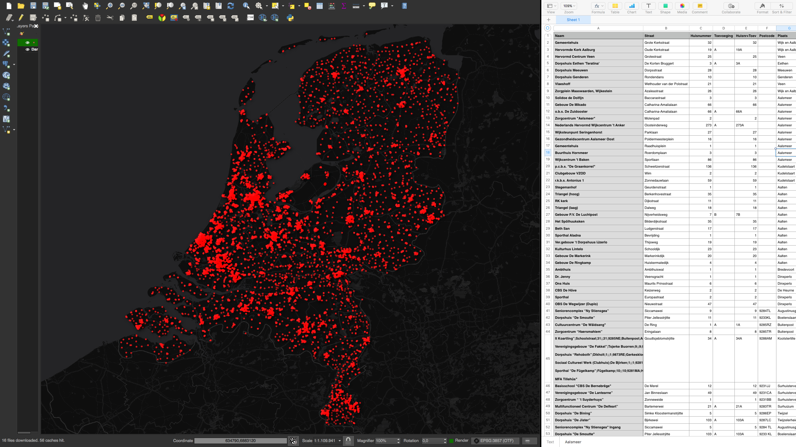
After a succesfull pilot during the National Elections in 2017, we, the Geodienst of the University of Groningen, are working on an update of our "Stemwegwijzer" (voting signpost in Dutch) for the upcoming municipal elections and the referendum in March 2018. On the website stemwegwijzer.nl voters can find the route to the nearest polling station based on their current location. Besided updating this application, we will also update our high quality open dataset which contains all Polling Stations in the Netherlands. You can download this data below.
This open dataset is created based on the polling stations mentioned on municipal websites. After gathering this information about all polling stations, they're provided with coördiantes. This is called geocoding. This geocoding process is based on the Key Register of Addresses and Buildings, the BAG. By checking these locations by hand, we're sure that the locations are exact.
The Geodienst is a successful spatial expertise group within the CIT. We work together with local and international researchers and partners, like Oxford, VU, UMCG, RTL, Provincie Fryslân, SER, TAUW, policy makers and local businesses on a diversity of innovative projects. We combine academic knowledge with an entrepreneurial inquisitive mindset. We have ample room to experiment, and use it to stay ahead of the game.
This data is free to use under the CC-BY licence with attribution to: Geodienst, University of Groningen.